
Running the Winchester Ways
Roger of 'IRunOffRoad', shares with us his experience of running the viaduct way and the historical Winchester spots he passed en route.
Hampshire has a hidden network of trails that span the county, some haven't altered in years, whereas some have been restored for us all to use. Today I was leaving the "madding crowds" of Winchester behind me and following in the footsteps of traders, maybe Romans, maybe Saxons and coming across buildings, forts or settlements that they would have passed, along with landmarks from the last two hundred years.

When Alfred the Great became King of Wessex in 871 he established Winchester as his capital so it’s not surprising that a number of Ways head in and out of the town. The definition of a Way is simply a path to travel along, however, where it takes you is the intriguing part.
The beauty of trail running is that you can cover more ground in a shorter space of time while still travelling slowly enough to take in your historical countryside surroundings.
My day started outside Winchester Guildhall which is where the Viaduct Way begins. This modern take on the traditional Way leads to the Hockley Viaduct which was opened in 1891 and was restored in 2013. After passing Alfred the Great's statue you take a sharp right-hand turn by the City Mill that then takes you along the banks of the Itchen river.
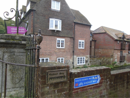
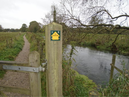
Keeping a look out for the Viaduct Way markers along College Street, College Walk and Domum Road you then run up the path made from the old railway embankment. Keeping your bearings with the water on your right-hand side. The river Itchen and the Itchen Navigation cross over in a number of places as you leave the town centre.
The Itchen Navigation was created to carry freight such as coal and timbers from Southampton to Winchester along the ten mile river/canal and it was only the advent of the railways that led to its decline. After passing under a small bridge you reach the Garnier Road car park and from this point on (a mile or so) you feel like you have escaped the town.
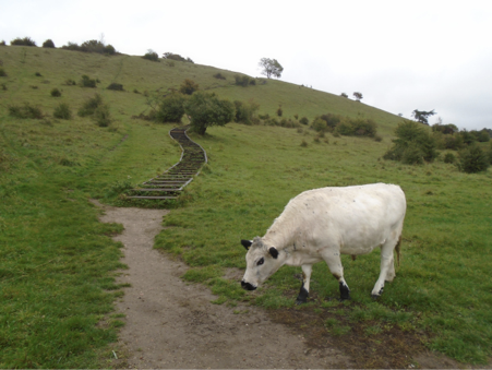
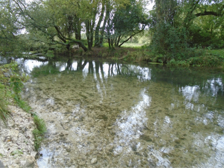
The water was in full flow here and again I was struck by how clear it was. Rising up to my left was St Catherines hill which was where I eagerly awaited its wooden steps. The 120 feet elevation has 333 steps and today it had its own gate keeper with this Bull!! Luckily, he wasn't the slightest bit interested in me so I set off on my ascent. The wood was quite wet from the earlier rain so caution was needed both going up and coming down. Once at the top the grey skies did detract a little from the view but you could see the tactical benefits the iron age fort would have had at the top.
I pondered what would Alfred the Great have been called today? Alfred the Awesome, Alfred the Legend ... we will never know!!
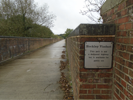
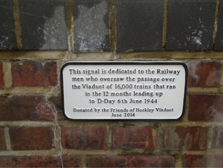
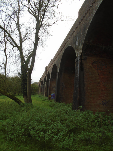
After running under another small railway bridge, I reached the cross roads, up the ramp to my right and then onto the viaduct. The railway line that crossed it was closed with the Beeching Act in the 1960's but after recent work by Winchester City Council it has been restored and it now makes up part of the National Cycle Network Route 23 for the benefit of all the #getoutdoors community of walkers, cyclists & runners. This sign was a fitting tribute to the viaducts role in both World Wars.
The run to the end of the viaduct meant I was just over 2.5 miles into my route. On returning to the cross roads I passed the sign that pointed me over the main road and under the M3. However, I couldn't resist a little more exploring which brought me out underneath the viaduct for this photo. I counted over 30 arches in total for the 600 metres.
Once under the M3 bridge what strikes you is both the speed and how clear, the water is. I had now started on the Itchen Way, this trail runs from the rivers source at Hinton Amper all the way to Woolston in Southampton. The Itchen Navigation flows largely next to it and once again recent initiatives have breathed new life into it after years of disuse due to the advent of the railways, thus conserving the river way for both the wildlife (salmon & otters) and access with the path. The Hampshire and Isle of White wildlife trust have won a number of awards for their work on this project.
The recent rain had made some of the route muddy but all in all it was in a good compacted condition. Inevitably I had to turn around as I didn't have quite as long to run as I wanted but I'd covered five miles on my outbound leg. I'd certainly consider carrying on to Eastleigh or Woolston in future weeks.
The sheep on the other side of the bank did make me wonder if I was running in the right direction but generally speaking the route was well signposted.
It's always great to explore and now I'm confident I know where I'm going I'll bring fellow runners next time to share the journey. As I ran back along the Navigation there were ducks bobbing, wild flowers swaying and I'm sure I saw a vivid dark blue dragonfly. However, that said there are occasional tree root outcrops, so do take care!!

Running back towards Winchester you'd have no idea the busy M3 wasn't far away and this is exactly why I love to run the trails. The sights and sounds of the water way changed with each twist and turn that it took, whether it was a couple of fishermen or the locks and sluices but my main memory will be the crystal clear water.
There were considerably more people out and about enjoying exactly where I'd just been as I retraced my journey.
This designated Special Area of Conservation winds its way back towards the ancient Capital of England and really does make for a therapeutic walk or run, that will take you back in time. Throw in a viaduct for good measure and that’s why I’d recommend the Winchester Ways.
If you would like to find out more about Roger and his passion for running, head over to his website for weekly updates and blogs. Alternatively, follow him on Twitter.